The Bureau of Meteorology is inching closer to declaring a La Nina alert, but the organisation's Head of Climate Prediction, Dr Andrew Watkins, says it's still taking a cautious approach.
Subscribe now for unlimited access.
or signup to continue reading
The Bureau's latest ENSO Outlook is at a La Nina alert, meaning there is a 70 per cent chance of one forming.
It's adopted a more conservative approach than the American National Oceanic and Atmospheric Administration, which has declared a La Nina.
Read more:
"I think their call is a good one for the US, we will make the call, for us, early next week," Dr Watkins said.
"All the models, we survey, are suggesting we will go into a La Nina, in October, we are touching on some thresholds, in the Pacific Ocean, at the moment - it's getting very close."
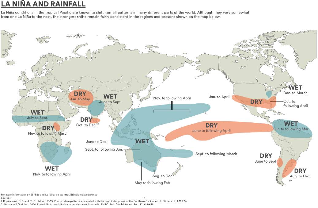
That would mean the odds of a greater than normal rainfall for at least 80pc of the northern half of Victoria, with slightly lower odds for the southern half.
"The outlook is pushing fairly firmly to the wet conditions, from October through to December, and October is looking like a wetter month," Dr Watkins said.
"It's not like the bureau declares a La Nina, a switch gets flicked, and it starts raining.
"It means we are likely to be locked into these wetter conditions, to the end of the year."
A La Nina would also mean cooler than average days, with more cloud, "which will keep the sun at bay" and warmer nights, as damper soil trapped heat.
"The NOAA have a slightly different definition to us, we look for particular changes in the trade winds, in cloudiness, and soil and measurement of pressure," Dr Watkins said.
"We are looking at the atmosphere, and also the ocean, how cool the central Pacific Oceean is, and the Southern Oscillation Index, as a measure of pressure.
"What we are looking for is when the atmosphere and the ocean lock in together and that guarantees an event will happen, well into the summer and even into autumn.
"We talk with the Americans regularly, we understand they are focussed on the impacts for the US, and we are more focussed on the impacts for us."
Read more:
Have you signed up to Stock & Land's daily newsletter? Register below to make sure you are up to date with everything that's important to Victorian agriculture.


