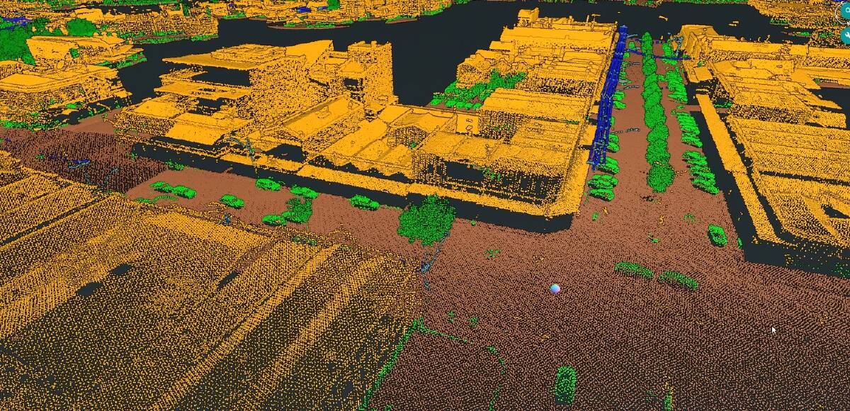
Helicopters are currently flying over Ballarat as energy distributor Powercor scans the region for bushfire risk.
Subscribe now for unlimited access.
$0/
(min cost $0)
or signup to continue reading
The helicopters are fitted with Light Detection and Ranging technology, essentially laser imaging cameras, and scan the network to measure the distance between trees and vegetation as part of Powercor's vegetation inspection and tree-cutting program.
It comes as the company continues to investigate regular power outages in the central highlands that have hit some towns like Trentham and Blackwood hard since the beginning of the year,
But Powercor has declared these power outages are not related to bushfire prevention or the REFCL cut off switches.
REFCL technology are safety devices that help respond to faults or other problems on the network and during fire season, the REFCLs and other network safety devices operate in more sensitive setting modes aimed at preventing fire from contact with wires.
Now Powercor has stepped up its use of technology with two Bell 505 helicopters flying more than 300 metres off the ground to scan the distance between powerlines and vegetation to within a 'couple of centimetres' across its entire network of more than 70,000 kilometres of powerlines.
Powercor then takes the data and processes it internally and creates 3D models of its network and vegetation to understand where tree cutting needs to take place.
IN OTHER NEWS:
With a team of highly qualified pilots, the Powercor flights are taking place over the next month across Ballarat, Daylesford, Gordon, Ballan, Buninyong, Clunes and surrounding areas.
While Powercor has used LiDAR technology in the past, it brought the program in-house in 2020, investing in its own helicopters, LiDAR sensors and processing team.
Powercor head of vegetation Chris Heinz said the technology massively increased the efficiency of its vegetation inspections.
"Prior to LiDAR, we used ground inspection, which is literally people on the ground, assessing vegetation in proximity to powerlines. Since we started using LiDAR and then insourced the capability, some of the key benefits are the ability to cover a lot of area very quickly," he said.
"A lot of places are difficult to access and the use of LiDAR, where you're flying above the powerlines, means getting into those areas is a lot more straightforward. It gives you the accuracy, you're using laser imaging to measure distances, as opposed to hand tools, rangefinders and the like."
Mr Heinz said it would take a couple weeks for the helicopters to scan the area, with tree cutting to take place all year round.
"We manage vegetation to reduce the risk of bushfire and make sure we're delivering power safely and reliably.
"I think that's at the core of vegetation management and this LiDAR inspection let's us measure to the centimetre in assessing the distances of vegetation to the conductors. It's a really useful tool that we've brought in house and we're really happy with how that's tracking.
"It's a big investment. It was something we wanted to take control of and invest in ourselves. It's a great importance we place on maintaining our vegetation appropriately, so that was something we were comfortable doing."
If you are seeing this message you are a loyal digital subscriber to The Courier, as we made this story available only to subscribers. Thank you very much for your support and allowing us to continue telling Ballarat's story. We appreciate your support of journalism in our great city.

